
Geological Time Scale
- Two time scales are used to measure Earth's age:
- sequence of layering of the rocks and the evolution of life
- natural radioactivity of chemical elements in rocks
- Eon -> Era -> Periods -> Epochs -> Stages

Cretaceous Period: development of flowering plants. Large diversity in dinosaurs but ending withe their sudden extinction approximately 65 million years ago. Formation of the Andes Mountains. African and South American plates begin to separate. Climate is cooling. Shallow seas are prominent."
- Key principles:
- rock layers (strata) are laid down in succession. With each strata representing a "slice" in time
- Superposition: the higher the layer, the newer/younger it is
- However, this scale can still be compromised by erosion, and layers laid down in different places at the same time look different, and a layer only represents a part of Earth's history

Earth's Structure
- Earth was formed 4.6 billion years ago
- Three sections of the Earth:
- Biosphere: all forms of life both on land and in sea
- Hydrosphere: all forms of water (fresh, saltwater, snow/ice)
- Internal Structure: divided into crust, mantle, and core
- crust is 0.5% of Earth's mass
- split into basalt rich oceanic crust and granite rich continental crust
- Continental Crust is composed of volcanic, metamorphic, sedimentary, and granite-type rocks
- The Moho is the boundary between the crust and the mantle
- The Mantle is solid, and the upper-third of it is the Asthenosphere, which is plastic-like

|
|

Plate Tectonics
- Continental Drift Theory
- In 1915, Alfred Wegener proposed the existence of Pangaea
- The evidence:
- Fossilized tropical plants in Greenland's ice caps
- Continents fit together like a puzzle
- Similarities existed in the rocks between east coasts of the North and South America and the west coasts of Africa and Europe
- Fossils of the same extinct land animals were found on separate land masses
- Tropical climates used to be polar based on the climatic data of the region
- Seafloor Spreading Theory
- rocks got older as they moved away from the ridge
- new crust being created at volcanic rift zones
- Subduction Zones: areas on Earth where two tectonic plates meet and move toward each other, with one sliding underneath the other and moving down into the mantle
- rocks got older as they moved away from the ridge
|
|
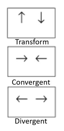
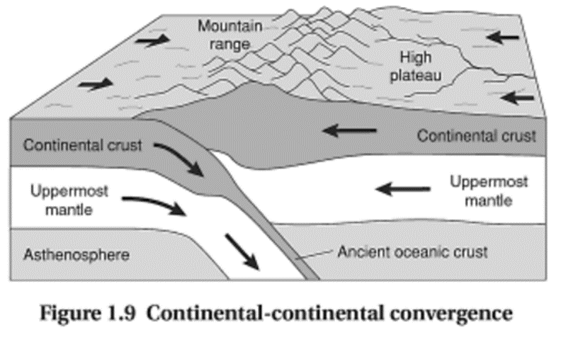
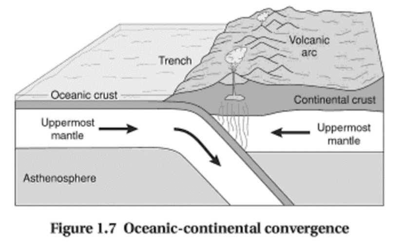
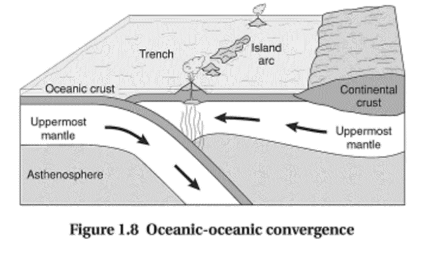
Convergent Boundaries can create different things depending on the crust
Continental-Continental -> Mountain Range Oceanic-Continental -> Volcanoes Oceanic-Oceanic: Island Arc (ex: Japan)
Continental-Continental -> Mountain Range Oceanic-Continental -> Volcanoes Oceanic-Oceanic: Island Arc (ex: Japan)
|
|
|
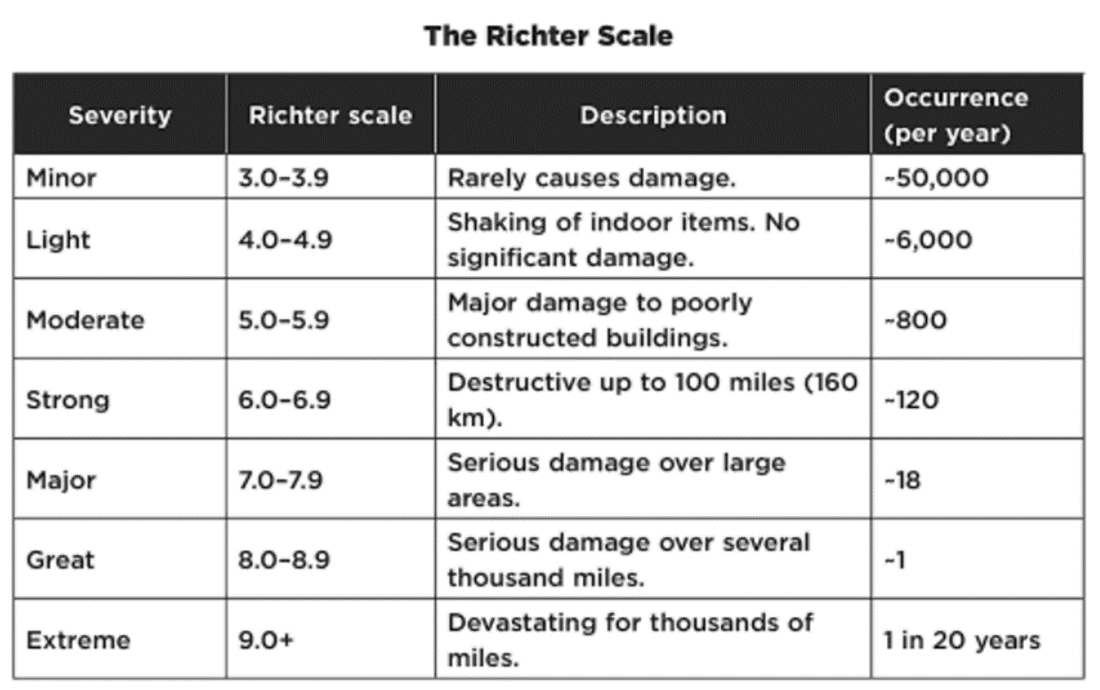
Earthquakes

- occur during abrupt movement on a fault
- energy held in place by friction is released
- Vocab:
- Focus: area where energy is released
- Epicenter: directly above the focus, on the surface
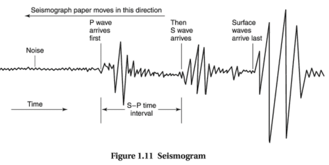
- Seismic Waves: waves that travel outward
- measured on the Richter Scale, recorded by the Seismograph onto a Seismograph
|
|
|
Two types of Seismic Waves:
1. Surface Waves
|
|

Tsunamis
- series of waves created when a body of water is rapidly displaced (usually by an Earthquake in a subduction zone)


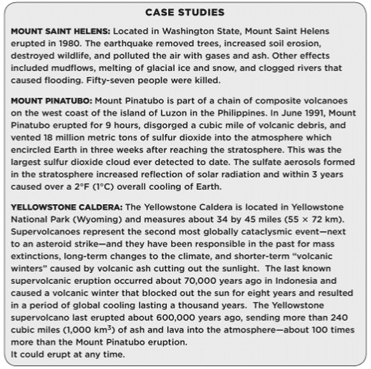
Volcanoes
- classified as Active, Dormant, or Extinct
- 95% of volcanoes occur at subduction zones and mid-oceanic ridges
- other 5% are at hot spots where magma is near the surface
- gases most commonly released by volcanoes are steam, carbon dioxide, sulfur dioxide, and hydrogen chloride
- Sulfur dioxide is converted to sulfate ions in the stratosphere
- can decrease global temperature
- usually turn into acid rain after staying the atmosphere for 2 years
- Safety with Volcanoes:
- better volcanic prediction, magnetic changes, changes in seismic activity, measuring changes in temperature and gas composition, evacuation plans, and study of precursors

(click on the picture above for a "Parts of a Volcano" worksheet)

Seasons
- determined by the tilt of Earth's axis (23.5 ° )
- Earth is closest to the sun in December, January, and February
- Earth is farthest away from the sun during June, July, and August
- Seasons are NOT caused by Earth's distance from the sun -> actually by the angle of sunlight


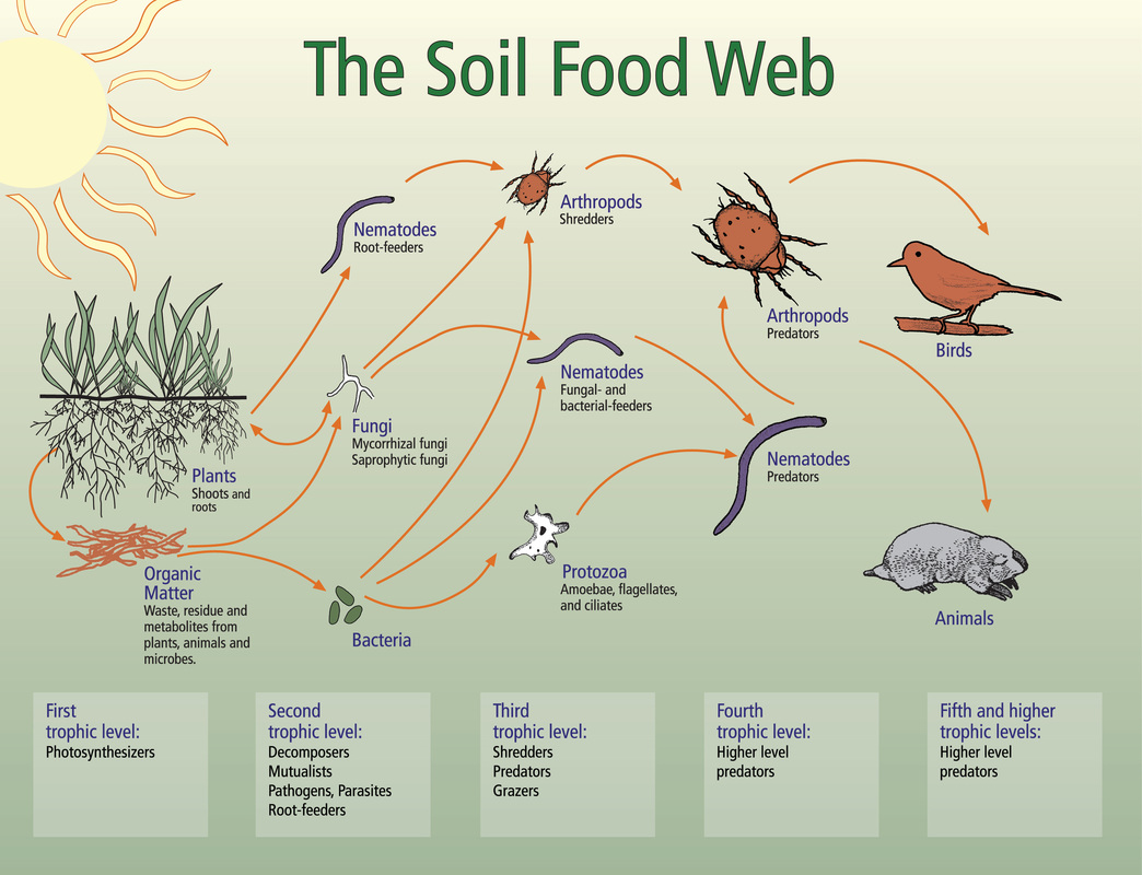
Soil
- soil components: air, water, minerals, and organic matter
- It develops in response to:
- Parent Material - rock and materials that the soil came from
- Climate - partial weathering of parent material measured by temperature and precipitation
- Living Organisms - bacteria, worms, snails, etc -> decompose
- Topography - physical characteristics: drainage, elevation, and wind exposure


(click on the picture to the left for a Soil Horizons worksheet)
Soil Horizons is a layer parallel to the crust, with each horizon having their own unique characteristics. Depending on the soil component, there are usually three or four soil horizons. Soil Horizons are defined by physical characteristics like texture and color.
Soil Horizons is a layer parallel to the crust, with each horizon having their own unique characteristics. Depending on the soil component, there are usually three or four soil horizons. Soil Horizons are defined by physical characteristics like texture and color.

Igneous Rock
formed by cooling of silica content
solidify deep underground
large grained texture (intrusive)
fine grained texture (extrusive)
becomes soil
Metamorphic Rock
formed by heat and pressure
ex: diamond, marble, slate, coal, etc
Sedimentary Rock
formed by piling of various materials over time
fossils are only trapped in this rock
